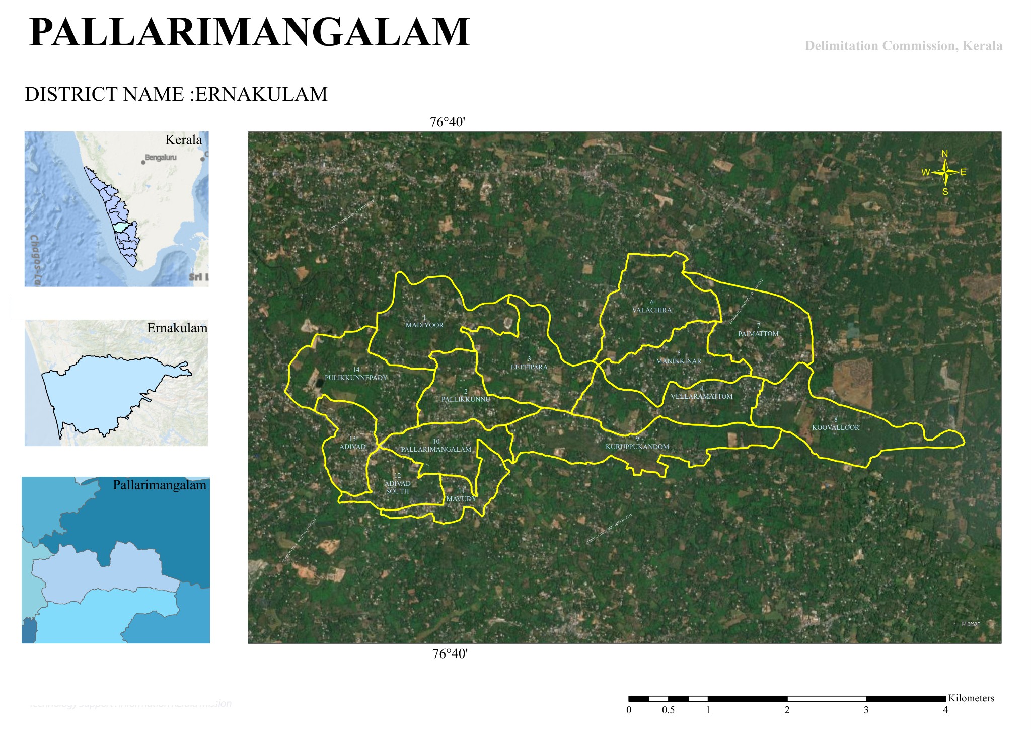

Map 2025
Pallarimangalam Grama Panchayat Map
A Brief Overview
Pallarimangalam Grama Panchayat is a Grama Panchayat located in Ernakulam District, Kerala. As per the 2025 Delimitation Commission Order, the Panchayat is divided into 14 wards (constituencies).
🗺️ Wards
Madiyoor
Pallikkunnu
Eettippara
Vellaramattam
Manikkinar
Valachira
Paimattom
Koovalloor
Kuruppumkandam
Pallarimangalam
Mavudy
Adivad South
Adivad
Pulikkunneppady
🏞️ Geographical Features
- The northern part of the Panchayat is primarily bounded by the Kothamangalam River.
- Major roads such as Adivad, Pareekanni, Kudamunda and Pothanikkad connect various wards.
- The Panchayat has a diverse geographical landscape comprising rivers, streams, paddy fields, bridges and hilly areas.
📍 Major Centres
Adivad
One of the major commercial and transportation centres of the Panchayat.
Residential Areas
Pallarimangalam, Madiyoor, Vellaramattam, Koovalloor and Mavudy are among the major residential areas.
👥 Population
The approximate population of each ward ranges from 976 to 1,129. The wards are organised to maintain a balanced distribution of population.
📌 At a Glance
Pallarimangalam Grama Panchayat is a predominantly rural and agricultural local body, influenced by the Kothamangalam River, with Adivad as one of its major centres, and administratively divided into 14 wards.